
Overview
Immersive Video Environment
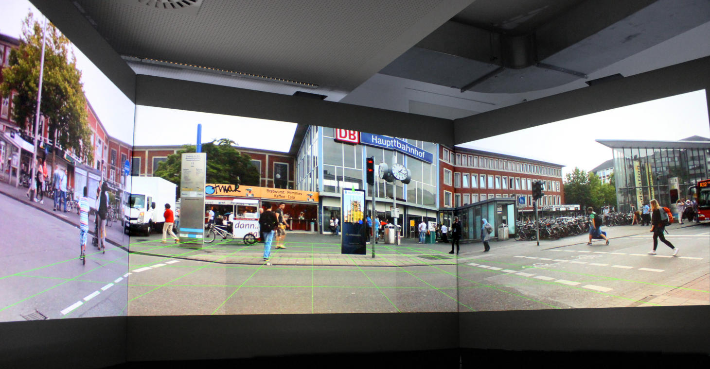
Public displays have become ubiquitous in urban areas. They can efficiently deliver information to many people and increasingly also provide means for interaction. Designing, developing, and testing such systems can be challenging, particularly if a system consists of many displays in multiple locations. Deployment is costly and contextual factors such as placement within and interaction with the environment can have a major impact on the success of such systems. In the course of our research we developed a new prototyping and evaluation method for public display systems that integrates augmented panoramic imagery and a light-weight, graph-based model to simulate such systems. Our approach facilitates low-effort, rapid design of interactive public display systems and their evaluation. We realized a prototypical implementation and carried out an initial assessment based on a comparison with existing methods, our own experiences, and an example case study.
Try it out yourself by opening the IVE itself in a web browser and the corresponding Remote Control App to choose a starting point.
If you want to see some functionalities of the system immediately, just watch the following video:
Ethermap
Ethermap is a real-time collaborative map editor allowing:
- synchronization of geoobjects between all clients
- visual highlights of changes creating user-awareness
- watching other users or show their current workarea
- basic feature version control (browse older revisions and revert changes)
- communicating about specific features within the chat
- How does it work? shortly explains the overall concept.
The application has been built as part of a master thesis. For a demo (desktop only), open Ethermap in several browsers and log into the same map id with different usernames or check out the following video:
Dialogmap
Dialogmap is a Rails/Angular single-page application to support dialogues with spatial references. It allows users to reference spatial features to parts of their contributions. Other users can write answers with own spatial references. It was developed in the context of a masters thesis with the title “Supporting public deliberation through spatially enhanced dialogues” by Gerald Pape. The aim of the thesis is to study the benefits applying dialogues on a map to public deliberation.
For a demonstration follow this link or if you immediately want to see some functionalities of the system, just watch the following video:
Biographical Thesaurus
The Biographical Thesaurus for North Rhine Westphalia is a tool useful to search for people, their profession, the time period they lived in, and their place of birth, death or activity. It was jointly developed by the Institute for Geoinformatics and the University Library https://www.ulb.uni-muenster.de/ as part of the LIFE project http://lodum.de/life/. The application uses the map as both search and display tool, and supports keyword-search for people, profession and place. RDF data about people is taken from the lobid API http://lobid.org/api, and the portal of the German National Library (DNB).
Geotagging
Geotagging is a tool to interact with georeferenced videos. By combining a map and a video player, it allows videos to be explored both temporally and spatially. The depiction of the viewsheds allows to select features on the map, which are then shown in the recorded video.